Transition Engineering Surveying LLC takes pride in providing exceptional service for your Land Surveying needs in Delaware, Maryland, Pennsylvania, and New Jersey since 2009. We provide excellent service no matter what your needs. From large residential subdivisions to commercial development to property surveys, let our competent, friendly team assist in completion of your projects.
Our team has highly skilled office and field staff that are safety-conscious and focused on providing accurate services on a timely basis.
We use Leica Smartnet with Global Navigation Satellite System (GNSS) network to allow for maximum precision from our RTK-enabled Global Positioning System (GPS) equipment. Our field teams utilize robotic total stations, data collectors and powerful electronic data management systems for their daily survey activities, including state-of-the-art Unmanned Aerial Vehicle (UAV) LiDAR and Imagery Drone and Digital Laser Scanning Equipment to encompass your surveying needs.
Professional Land Surveying Services
Includes most types of surveys:
- Aerial Drone LiDAR and Imagery Surveying
- Ground Hi-Density Laser Scanning Surveying
- (New) Integrated survey grade wireframe laser data scanning
- Deed Plots, Deed Composites and Land Ownership Plans
- Land Condemnation, Acquisition, Disposition, Partitioning of Land and Exhibit Plans
- Title, Metes and Bounds, Mortgage, Retracement, Boundary and Property Surveys
- Foundation As-Built Surveys and Certifications
- Property Corner Surveys and Certifications
- ALTA/NSPS Land Title Surveys
- Geodetic, GPS and Control Surveys
- FEMA Flood Line and Flood Delineation Surveys, Elevation Certificates and LOMA processing
- Wetlands Surveys
- Aerial Topographic Surveys Planning, Controls, Edits and Accuracy Checks
- Right of Way / Route Surveys
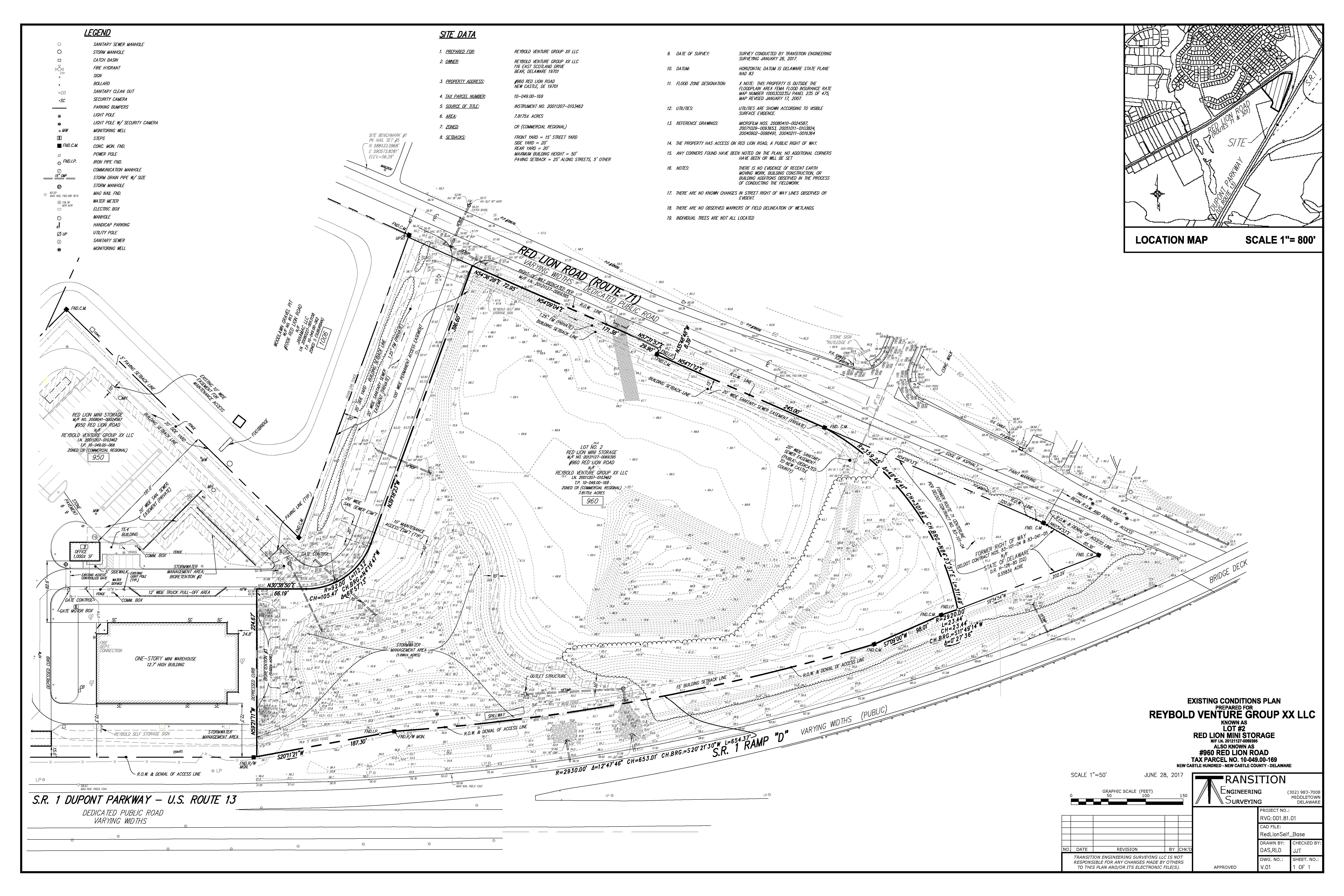
- Existing Conditions Surveys
- Topographic Surveys and Supplemental Topographic As-Built Surveys
- Perimeter Topographic Utility Base Mapping Surveys for Civil Engineering Design
- Industrial Site and Landfill Surveys
- HazMat Surveys (40 hour OSHA HAZWOPER trained)
- Subdivision Plans
Professional Engineering Services including direct engineering support for:
- Land Planning, Quantity Takeoffs, Lines and Grades Plans, Site Plans and Profiles
- Erosion and Sediment Control Plans
- Drainage, Hydraulics and Hydrology, Stormwater Drainage Design and Stormwater Management, Water Distribution plans, and Sanitary Sewer Design
- Design of pavement sections and street improvements